卫星遥感
卫星遥感
 精准监测
精准监测
 提前预警
提前预警
 自主可控
卫星遥感
精准监测
提前预警
自主可控
自主可控
卫星遥感
精准监测
提前预警
自主可控
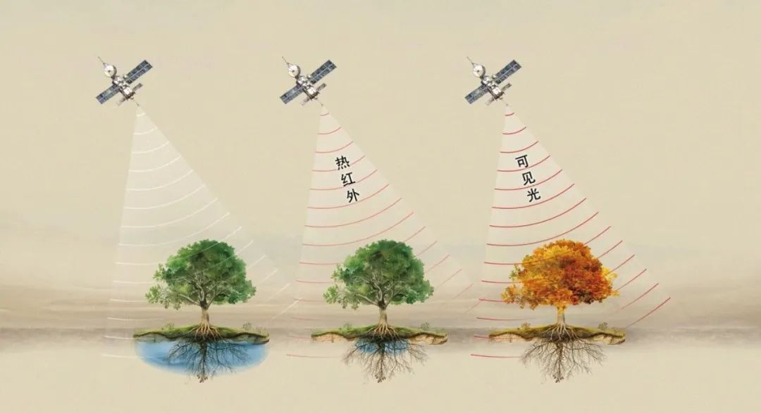
1、卫星遥感反演
Satellite Remote Sensing Inversion
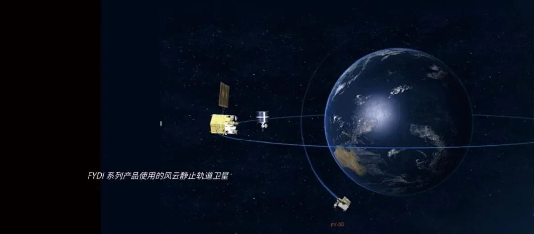
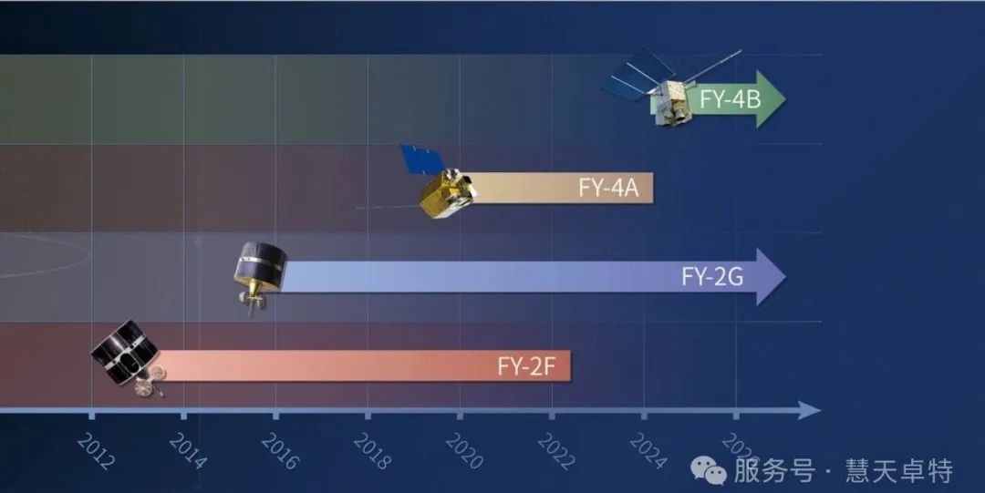
本产品利用中国静止轨道风云系列气象卫星(FY-2和FY-4)的地表温度产品,融合了风云卫星东星和西星的不同观测角度,充分发挥对我国及周边区域大范围全天候(每天24小时)多频次观测的优势,利用近10年近十多年的卫星遥感数据(2013年-至今)对干旱情况进行了长时间序列的监测、分析和模型修正。
This product utilizes surface temperature data from China's geostationary Fengyun series meteorological satellites (FY-2 and FY-4). It merges observations from the eastern and western satellites to enhance multi-angle coverage. The system offers extensive, all-weather monitoring across China and neighboring regions with frequent updates throughout the day (24/7). Leveraging over a decade of satellite remote sensing data (from 2013 to the present), this product conducts long-term monitoring, analysis, and model adjustments for drought conditions.
基于风云卫星红外波段的观测,通过能量平衡-诊断性的反演方法,推算地表干旱状态,实现高分辨全覆盖实时监测。产品不依赖地面站点观测,也无需任何降水信息,因此,在以下情况有着巨大优势:
Based on observations from the infrared bands of Fengyun satellites, this product applies an energy balance-based diagnostic inversion method to estimate surface drought conditions. This enables high-resolution, comprehensive real-time monitoring without relying on ground station data or precipitation information. The independence from ground-based observations provides significant advantages in the following scenarios:
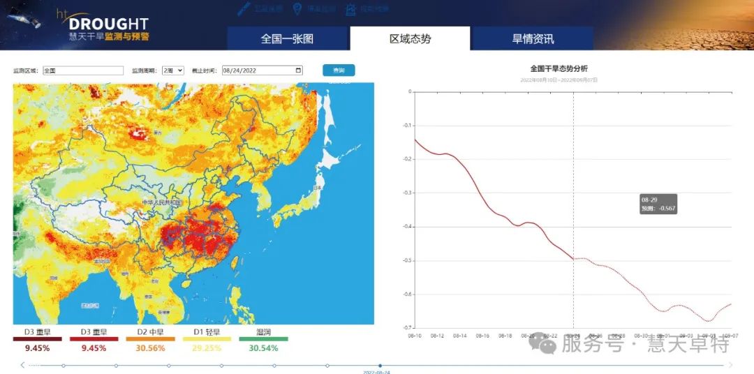
2、全天候精准监测
All-Weather Precise Monitoring
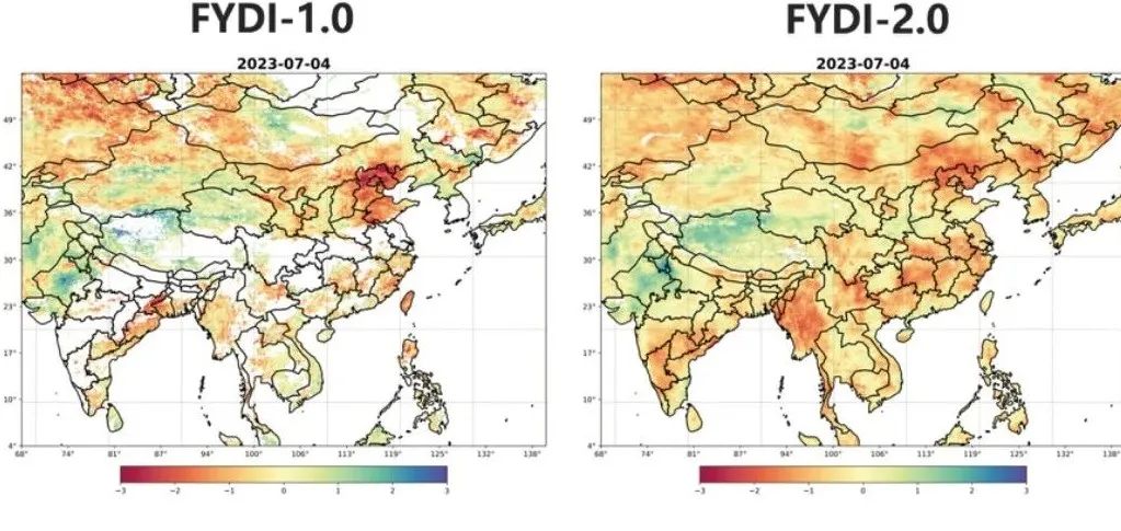
FYDI-1.0干旱产品与地面站点观测和气象干旱综合指数进行了充分的验证,与2343个地面观测有效站点,5年时间内的相关系数达0.7。经过1年半的验证评估和模型修正,在我国青藏高原地区、西南4省市、南亚等地区,开展了实时干旱监测,精度和准确度有了进一步的提升。FYDI-2.0基于自有专利,利用人工智能融合算法,结合遥感热红外和遥感微波观测的各自优势,生成高分辨率、高精度且全天候覆盖的干旱监测产品,相当于FYDI-1.0增加了如下优势:
FYDI-1.0 underwent comprehensive validation against ground station observations and meteorological drought indices. In testing across 2,343 valid ground stations over five years, it achieved a correlation coefficient of 0.7. After 18 months of evaluation and model refinement, real-time drought monitoring was deployed in challenging regions such as the Tibetan Plateau, the four southwestern provinces of China, and parts of South Asia, significantly improving accuracy and precision.
FYDI-2.0 builds upon these achievements by introducing a proprietary AI-based fusion algorithm. This version combines the strengths of thermal-infrared and microwave remote sensing to generate high-resolution, highly accurate drought monitoring products with all-weather capabilities. Compared to FYDI-1.0, FYDI-2.0 offers several key improvements:
FYDI-2.0空间覆盖度显著提高
FYDI-2.0 significantly improves spatial coverage
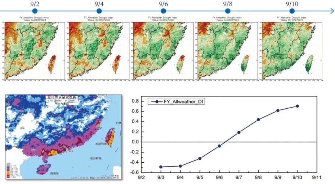
FYDI-2.0在“海葵”台风过境时段的监测
FYDI-2.0's monitoring during the passage of Typhoon 'Haikui'
3、提前预警
Early warning of drought conditions
本产品基于遥感卫星热红外波段反演的蒸散干旱指数,对地表缺水状态反应更为敏感,相对于可见光波段的监测方法,能提前7-14天探测到干旱。
此外,利用深度学习算法,基于过往长时间序列的监测数据生成的数据模型,结合降雨和温度等预报数据,我们能提供未来30天到60天干旱指数的预测。This product leverages the evapotranspiration drought index, derived from the thermal-infrared band of remote sensing satellites, making it more sensitive to surface water deficiency than visible-band monitoring methods. Its advanced detection allows for early drought identification 7 to 14 days ahead of conventional approaches.
Additionally, the product incorporates deep learning algorithms trained on long-term monitoring data. By integrating rainfall forecasts, temperature predictions, and historical patterns, the system can forecast drought indices for 30 to 60 days into the future. This predictive capability offers critical lead time for managing agricultural practices and mitigating drought impacts efficiently
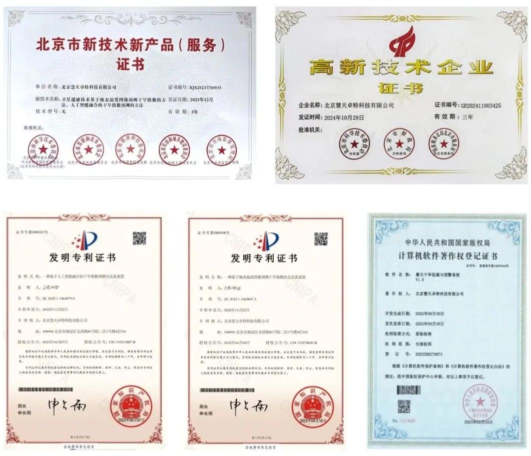
4、产品自主可控
Independent and Controllable Products
本产品完全自主可控,主要体现在如下几方面:
This product is fully self-reliant and independently controlled, as demonstrated by the following key aspects:
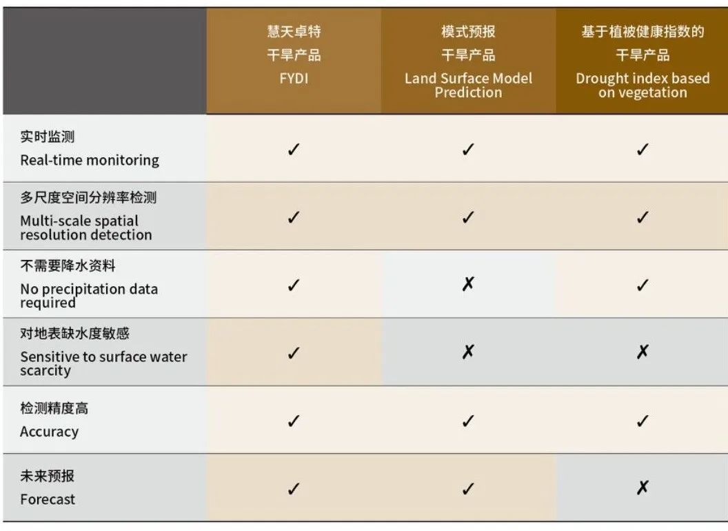
不同干旱产品算法的优缺点比较
Comparison of Drought Algorithms
系统架构
System Architecture
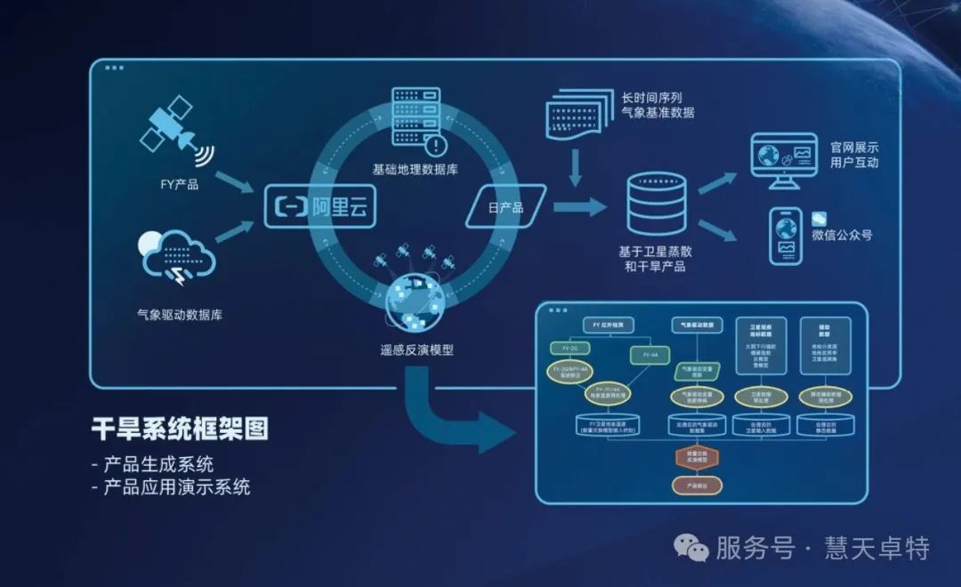
慧天卓特干旱监测与预测系统,采用Spring Cloud 技术生态相关的框架和工具栈,实现基于风云卫星遥感的实时在线干旱监测和预测,监测的结果可通过PC 浏览器或微信公众号实时浏览访问,干旱产品也可通过FTP、SFTP 等方式提供。
The Huitian Zhutuo Drought Monitoring and Forecasting System leverages frameworks and tools from the Spring Cloud technology ecosystem to enable real-time online drought monitoring and forecasting using Fengyun satellite remote sensing data.
Monitoring results can be accessed in real-time through PC browsers or WeChat public accounts. Additionally, drought data products are made available through FTP or SFTP protocols, providing flexible delivery options to meet various user needs.